

|
Tweet
Pin
It
|
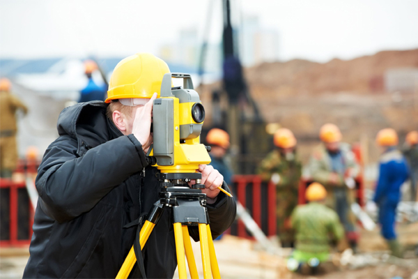
Surveying is a profession suitable for analytical thinkers with an interest in spatial information and discovery of the world around us. Surveyors can pursue a wide variety of specializations in their fields, and have the opportunity to work in almost any part of the world. The technique or science of measuring the position, distance and the angles of earthly surface is known as surveying. Surveying is generally used to make land maps and boundaries. Surveyors are experts in measurement and measurement systems. A surveyor, sometimes referred to as a land surveyor, is responsible for accurately measuring (surveying) land in order to plot out exact locations and distance between points. To accomplish their objective, surveyors use elements of geometry, engineering, trigonometry, mathematics, physics and law.
Surveyors measure and draw what the earth's surface looks like. Surveys are done in the air, sea and underground, too. They work outdoors and indoors, in mountainous terrain and cities, and even map land under water. Surveying with reference to professional practice, can be grouped into Land Surveying, Hydrographic Surveying, Cadastral Surveying, Mine Surveying, Building & Quantity Surveying, and Valuation Surveying. Professional surveyors measure and analyze angles and distances between property corner markers and to physical features on a piece of land. Under the ground, mining surveys are done to show what raw materials are available and where they are located. A surveyor must accurately indicate land elevations, property lines, land contour for development, division of land or many other purposes. They write descriptions of land for deeds, leases and other legal documents, define airspace for airports and take measurements of construction and mineral sites. A land surveyor is responsible for taking accurate measurements and recording the exact land layout in order to assist in the production of maps, graphs or other documents.
Surveying has been an essential element in the development of the human environment since the beginning of recorded history (about 5,000 years ago). It is required in the planning and execution of nearly every form of construction. Wherever there are roads, railways, reservoir, mines, dams, retaining walls, bridges or residential areas to be built, surveyors are involved. Based on the surveyors' findings, architects, engineers, and drafters decide on the most economical use of the land. Engineering, especially civil engineering depends heavily on surveyors. With the passage of time, land surveying tools and techniques has advanced, and the role of land surveyors is much broader than it was in the past. Earlier only chains and compasses were used as measurement tools, but now for larger projects, surveyors are increasingly using more accurate tools such as Global Positioning System (GPS), a satellite system that precisely locates points on the earth by using radio signals transmitted via satellites.
Surveyors have to work indoors in offices, as well as outdoors and that too enduring all types of weather. Traveling is sometimes part of the job, and land surveyors and technicians may commute long distances, stay away from home overnight, or temporarily relocate near a survey site. Surveyors work indoors while planning surveys, searching court records for deed information, analyzing data and preparing reports and maps.
Tags
environmental career
Find it Useful ? Help Others by Sharing Online
Comments and Discussions |
Related
Career Options
|
|||
|
|