Tuesday, July 1, 2025

|
Tweet
Pin
It
|
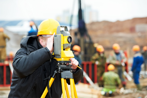
The advent of commercialization in every sector of the economy and the real estate boom, has led to a huge demand for surveyor jobs for freshers in India. Those with a knack for math and a love for the outdoors seem to fare well in this career.
Surveyors can get employment with construction firms, mining and oil and gas extraction companies. Surveyors can also work with transportation agencies like railroads, highways and major roads. Surveyors can even work with urban planning, which is the surveying of cities and major metropolitan areas. In the public sector, they can find employment in Geological survey of India, Indian Forest Service, National Imagery and Mapping Agency (NIMA) etc. Valuation surveyors/ real-estate appraisers, in addition to self employment or employment in an established firm of valuers, can find employment in several State and Central Government Departments where personnel with this specialized training are required in senior positions such as Income tax department, town planning and valuation department, port trust authorities, municipal corporations etc.
Surveying opens up many different employment prospects. With reference to professional practice, Surveying can be grouped into Land Surveying, Hydrographic Surveying, Cadastral Surveying, Mine Surveying, Building & Quantity Surveying, and Valuation Surveying. Surveyors can choose from a number of paths in this exciting field, specifically construction, boundary, hydrographic, geodesy, photogrammetry, GIS, and forensic surveying.
Hydrographic Surveys
Hydrographic surveys provide information about the depth of harbors,
bays, and other large bodies of water. Hydrographic surveyors map the
sea floor, shipping channels, waterways, ports, locate currents, shore
lines and other marine features, as well as map maritime zones. They
are usually associated with marine authorities. The shipping industry,
government researchers, oil companies, and utility networks rely heavily
on these types of surveys.
Cadastral or Boundary Survey
Cadastral or Boundary surveyors measure, mark, and map the boundary
lines of land ownership. They measure the property corners, or the delineation
from a neighboring piece of property. Boundary surveyors can also serve
as expert witnesses for court cases involving boundary disputes by producing
of documents, diagrams, sketches, plans, charts, and maps that they
have documented. Cadastral Survey is also used to maintain records
of public lands by some countries.
Construction or Building & Quantity Survey
Quantity Surveying is done for efficient management of construction
projects and to effect economy. Construction surveying is applicable
in very construction work be it bridges, houses, skyscrapers, underground
tunnels, pipelines, utility networks, refineries, shopping centers,
and offshore oil rigs. Construction surveyors take measurements and
make recommendations to engineers, architects, other professionals,
and contractors at all stages of construction projects- be it in the
inception, planning, design and drawing stage, management of contracts
and even to settlement of claims and dispute stages. Quantity Surveyors
who carry out work on behalf of a client organisation are known as a
Professional quantity surveyor, and those who work for construction
companies, are known as Contractor's quantity surveyor.
Topographic survey
Topographic surveys indicate the elevations of mountains and the depth
of valleys, as well as the location of rivers, lakes, and other landmarks.
Geodesy
Geodesy is closely connected to astronomy. These surveyors determine
the size and shape of the Earth and the precise location of points on
its surface. Geodesy is used to guide sailing ships and water traffic.
Surveyors measure as well as record rising sea levels, continental drift
and earthquakes. Geodesists with the help of global positioning systems
(GPS) can tell the exact position of an object on the Earth’s
surface.
GIS analysts
GIS analysts work with software programs to electronically map locations
around the globe.
Photogrammetrist / Remote Sensing Analyst
Photogrammetry is a type of remote sensing or gathering information
about a site without actually coming in contact with it. Photogrammetrists
extract spatial information from aerial or terrestrial photographs and
from digital imaging systems using satellite and airborne sensors. Photogrammetrists
take aerial photos and use them to create detailed maps of large areas
in a very short time and for land inaccessible on foot.
Forensic Surveyor / Expert Witness
The data this specialist collects, analyzes, and maps is typically included
as evidence at a trial, hearing, or lawsuit. Surveyors who build reputations
in the forensics field and serve as expert witnesses are in high demand.
Valuation Survey
Valuation Survey now referred commonly as appraisal, involves valuation
of the worth of land, buildings or possessions for specific purpose.
Valuation surveyor is a highly skilled professional, who with matured
technical expertise and skill prepares the value of property in money
terms and interpret the relationship between costs and benefits as a
rate of return, thus allowing the investor to make a choice between
alternatives. A professional valuer, in the field of Valuation of Real
Estate, values land for the client, for the purpose of purchase or sale
of land, mortgaging property, assessing the damage to property for insurance
purposes, rate the property for taxation or tax reduction, for company
takeovers and mergers, bank loans and other funding activities etc.
Find it Useful ? Help Others by Sharing Online
Comments and Discussions |
|
|||||||||||||||||||||||||||||||||||||||||||||||||||||||||||||||||
|
|||||||||||||||||||||||||||||||||||||||||||||||||||||||||||||||||
|
|||||||||||||||||||||||||||||||||||||||||||||||||||||||||||||||||
|
|||||||||||||||||||||||||||||||||||||||||||||||||||||||||||||||||
|
|||||||||||||||||||||||||||||||||||||||||||||||||||||||||||||||||
|
|